Downtown Bike Network

President Street Bike Lane Improvements

The Baltimore Complete Streets ordinance requires Baltimore City Department of Transportation to retrofit improved walking, biking, and transit infrastructure onto streets during routine resurfacing.

President Street began resurfacing prior to the ordinance taking effect, but BCDOT was able to make some last minute changes in the design to add high visibility crosswalks and a flex post buffer to the previous substandard bike lane.

While President Street is still far from a safe, all-ages street, we are thankful for these improvements. We will continue to advocate for BCDOT to extend this separated treatment up Fallsway, creating a more visible and safer Jones Falls Trail while connecting to existing protected bike lanes on Centre and Monument Streets.

Downtown Bike Network Resumes Construction

Downtown Bike Network Construction Timeline (courtesy of BCDOT)

Downtown Bike Network Construction Timeline (courtesy of BCDOT)

The Downtown Bike Network resumes construction this week. For full details, please visit Baltimore City Department of Transportation’s Downtown Bike Network page.

Background

The Downtown Bike Network was originally slated to be completed over a year ago. Construction was halted during the Potomac Street fire access discussion, and the Baltimore City Fire Department required a full re-design of the Downtown Bike Network before construction could resume.

We believe a re-design to comply with arbitrary fire clearance standards was unnecessary, and successfully fought to overturn that piece of fire code to prevent those standards from affecting projects again.

However, this fight occurred alongside the construction halt on Downtown Bike Network. So we worked with Baltimore City Department of Transportation on a re-design that improved significant portions of the design while also maintaining the at-the-time required fire clearance.

New Design Monument/Centre (the good)

The new design creates a fully-separated, two-way bike lane along Centre and Monument Streets from MLK/Eutaw to Washington Street. This will allow direct connections to future separated lanes on Wolfe or Washington Streets to the East, and to the future MLK sidepath and Eutaw Place separated lane.

The design replaces the original protected lane on Madison Street east of Guilford Avenue, replacing it with the two-way facility on Monument.

New Design Madison (not so good/opportunity to improve)

West of Guilford Avenue, Madison Street is planned to have a combination of separated lanes and buffered lanes, the latter being a requirement in portions due to the fire code. This section has been strongly opposed by the Director of Baltimore School for the Arts, and as a result, implementation has been delayed until Summer 2019.

Madison Street needs a re-design that calms traffic along the corridor. It is dangerous and contributes to economic decline of the corridor.

This delay in implementation is both a disappointment and an opportunity. The fire code update will go into effect in the end of October, which gives us the winter to discuss a better design for Madison Avenue that will meet the needs of people biking, the community desire for real traffic calming, and Dr. Ford’s concerns at Baltimore School for the Arts.

However, the delay until Summer 2019 may mean the grant will expire, causing us to lose the money to construct any design on Madison Street. This would be an unacceptable outcome. BCDOT must work to ensure any delay does not end with an expired grant, and must accept that some stakeholders may never accept infrastructure changes, even when they address critical street safety issues.

Changes on Maryland/Cathedral

Certain portions of the Maryland Avenue cycle track contain construction errors in the original design, including at the Pratt Street intersection. Other portions are regular conflict points, like at Centre Street and at the Lexington Street parking garage. Resuming construction of the Downtown Bike Network will allow us to fix these sections with correct and/or improved designs that will make the Maryland Avenue cycle track safer for all users.

Overall

The Downtown Bike Network will create a critical cross town connection that can be expanded upon into East and West Baltimore over the next 2-3 years. We’re thankful that BCDOT is taking a bold step in creating another high quality connection, and that they used this delay to think creatively and improve designs.

We will advocate to use the winter to improve the Madison Street design for a spring implementation that does not risk grant expiration.


Downtown Bike Network Update

The Downtown Bike Network, previously on construction hold due to Baltimore City Fire Department's unique interpretation of International Fire Code, has been re-designed with that interpretation in mind by Baltimore City Department of Transportation.

The new design switches from one-way pairs of infrastructure along Madison and Monument Streets to a fully-separated two-way bike lane along Centre and Monument Streets. This is a major improvement over the original design, providing a fully separated corridor along the length of the project. A buffered bike lane on Madison in Mount Vernon is maintained to provide traffic calming long requested by the Mount Vernon Belvedere Association.

In no place are existing condition street widths being reduced, and in many locations clear widths are being increased, so there should be no issue with Baltimore City Fire Department approval. If approved by Baltimore City Fire Department, the project construction will resume and hopefully be complete by end of Summer 2018.

We thank Baltimore City Department of Transportation for their effort in this re-design, which manages to both address unreasonable fire access demands while improving the separation of the facility.  


#FightForBikes 2.0

Skip the background, what can I do right now?

Fill the Room. Show up and Speak out at the following meetings:

  1. Covington Street Cycle Track | Wednesday, May 9 | 6:30-8:00pm

  2. Downtown Bike Network | Monday, May 14 | 6:30-8:00pm

  3. Downtown Bike Network | Tuesday, May 15 | 6:00-7:30pm

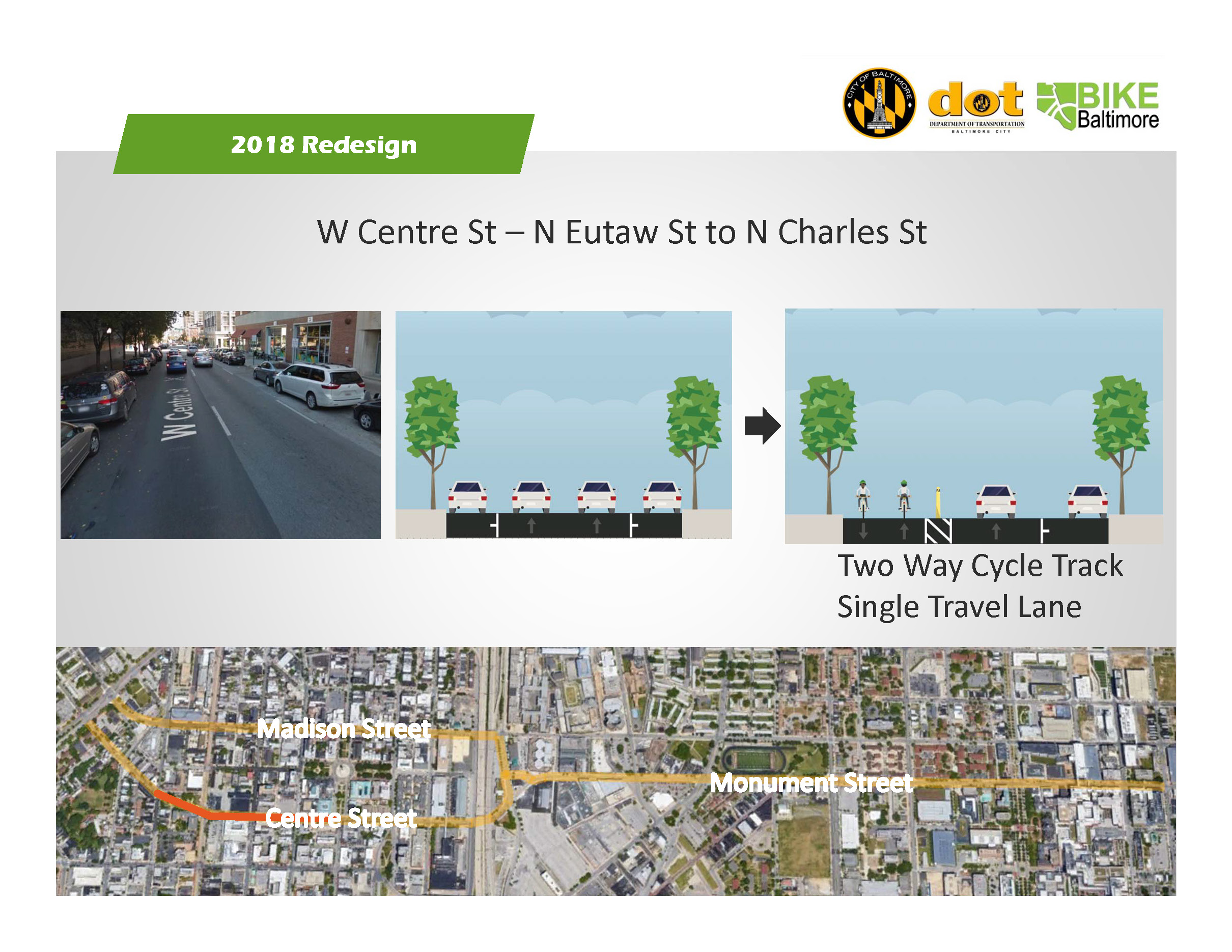
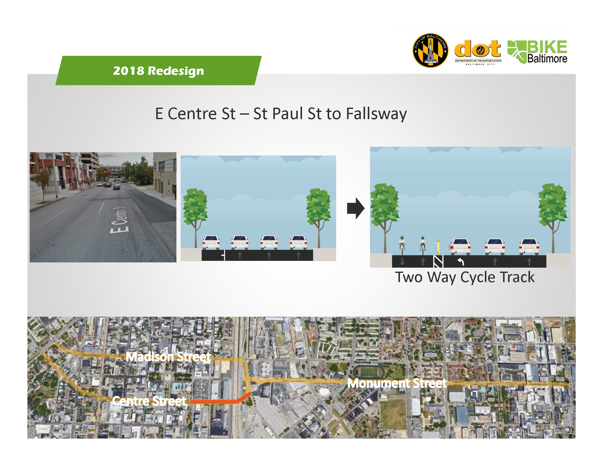
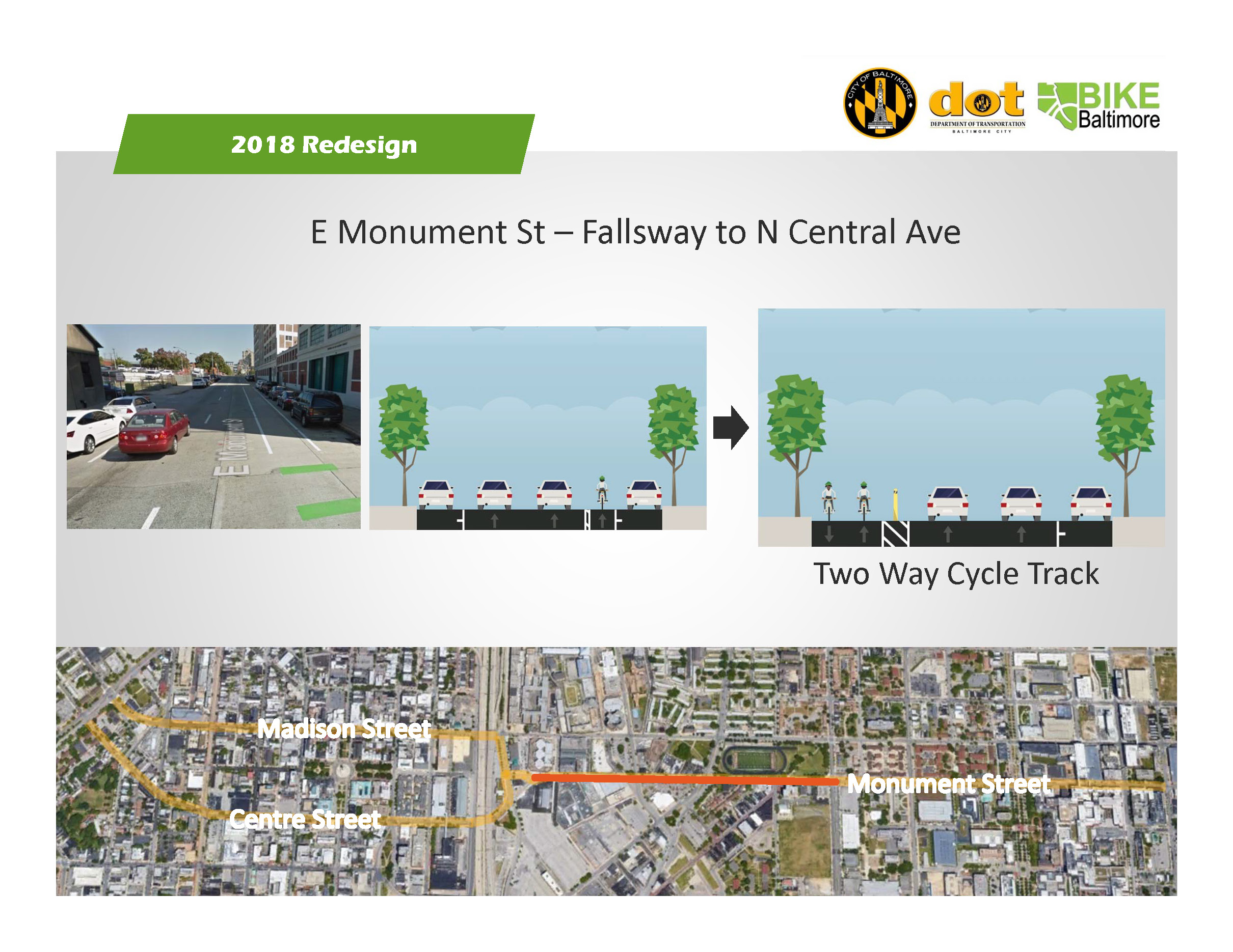
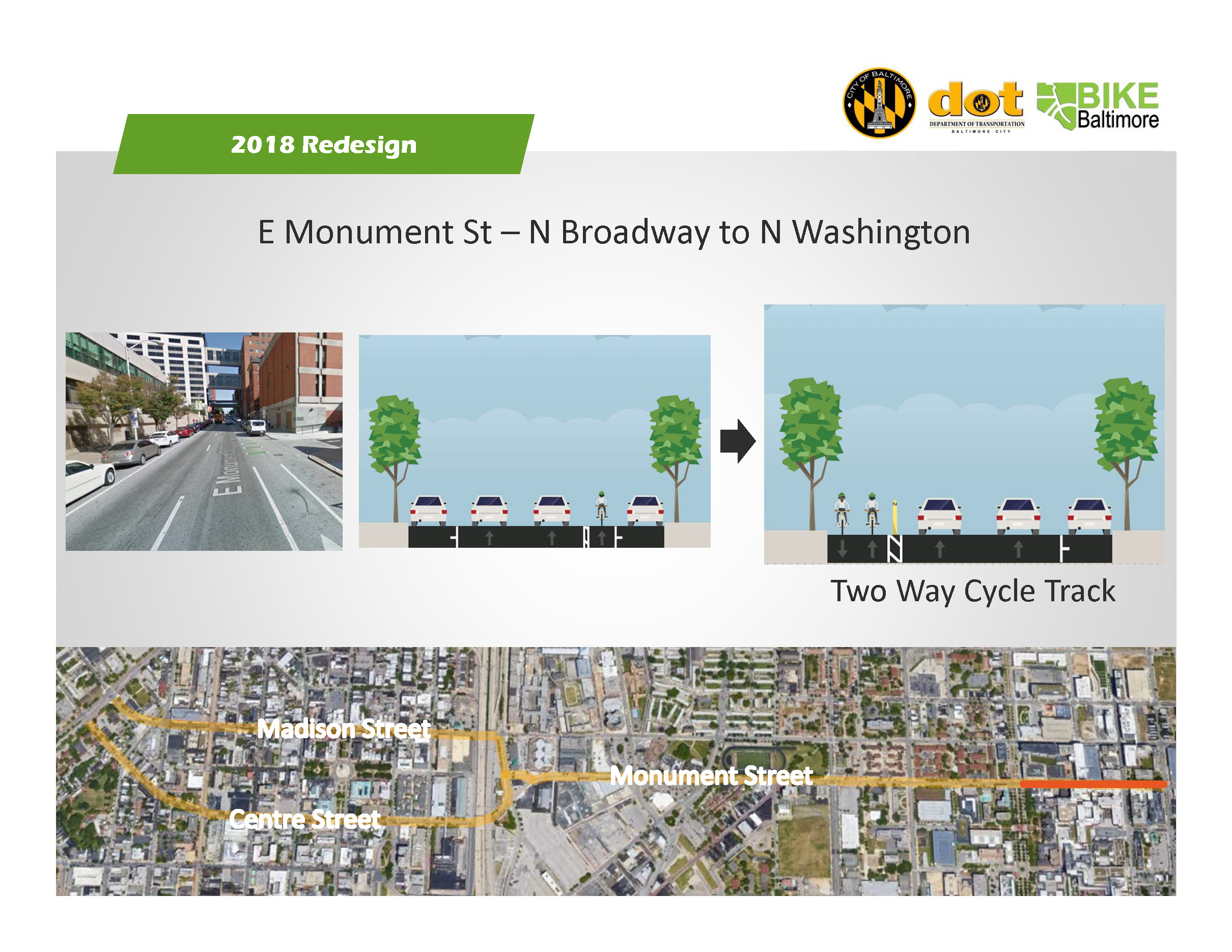
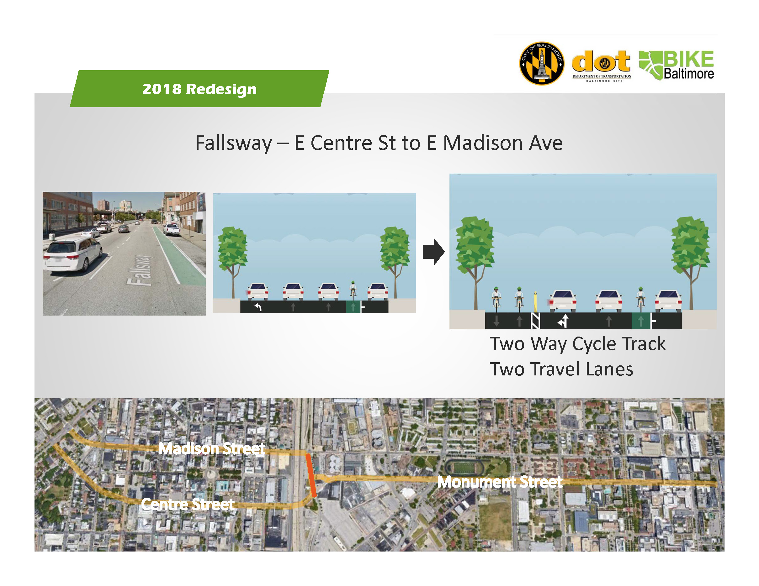
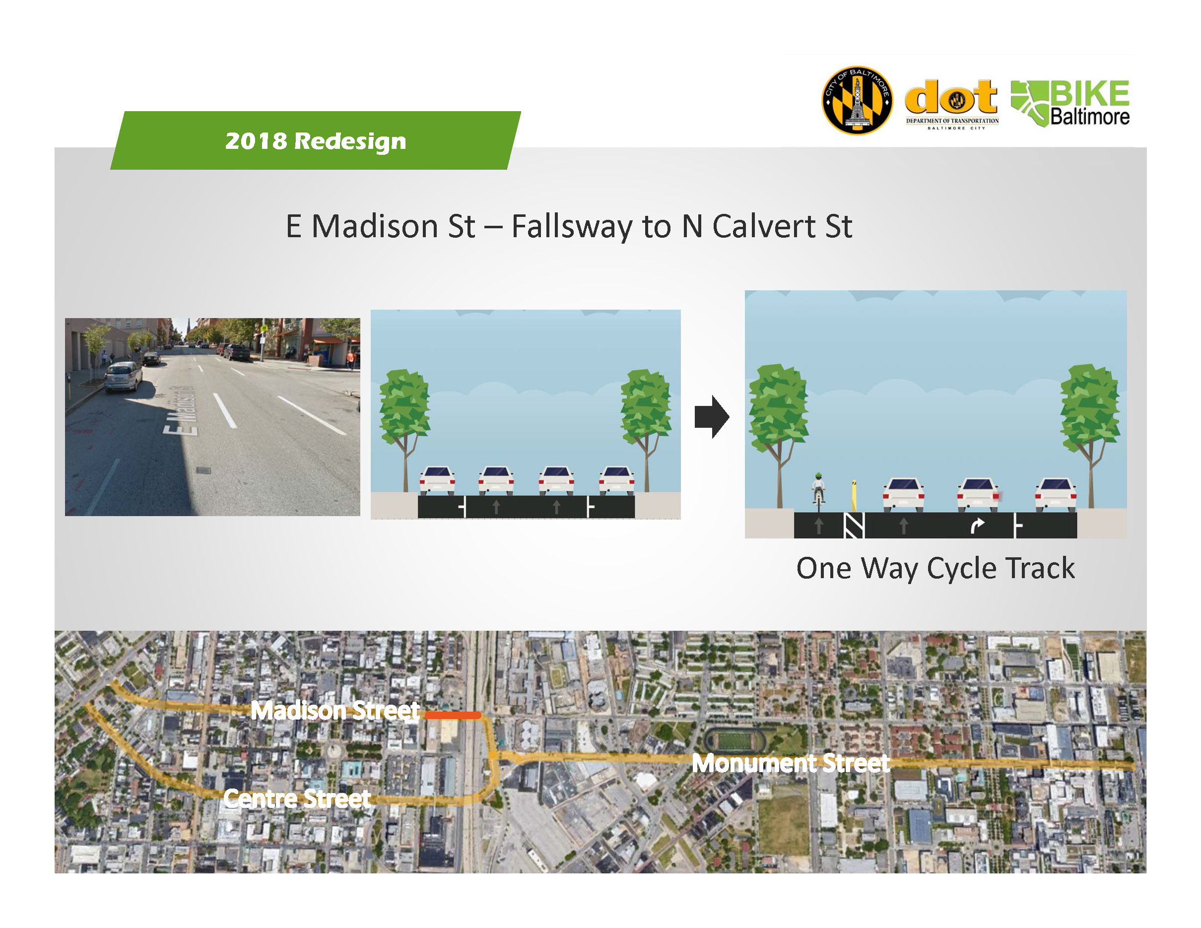
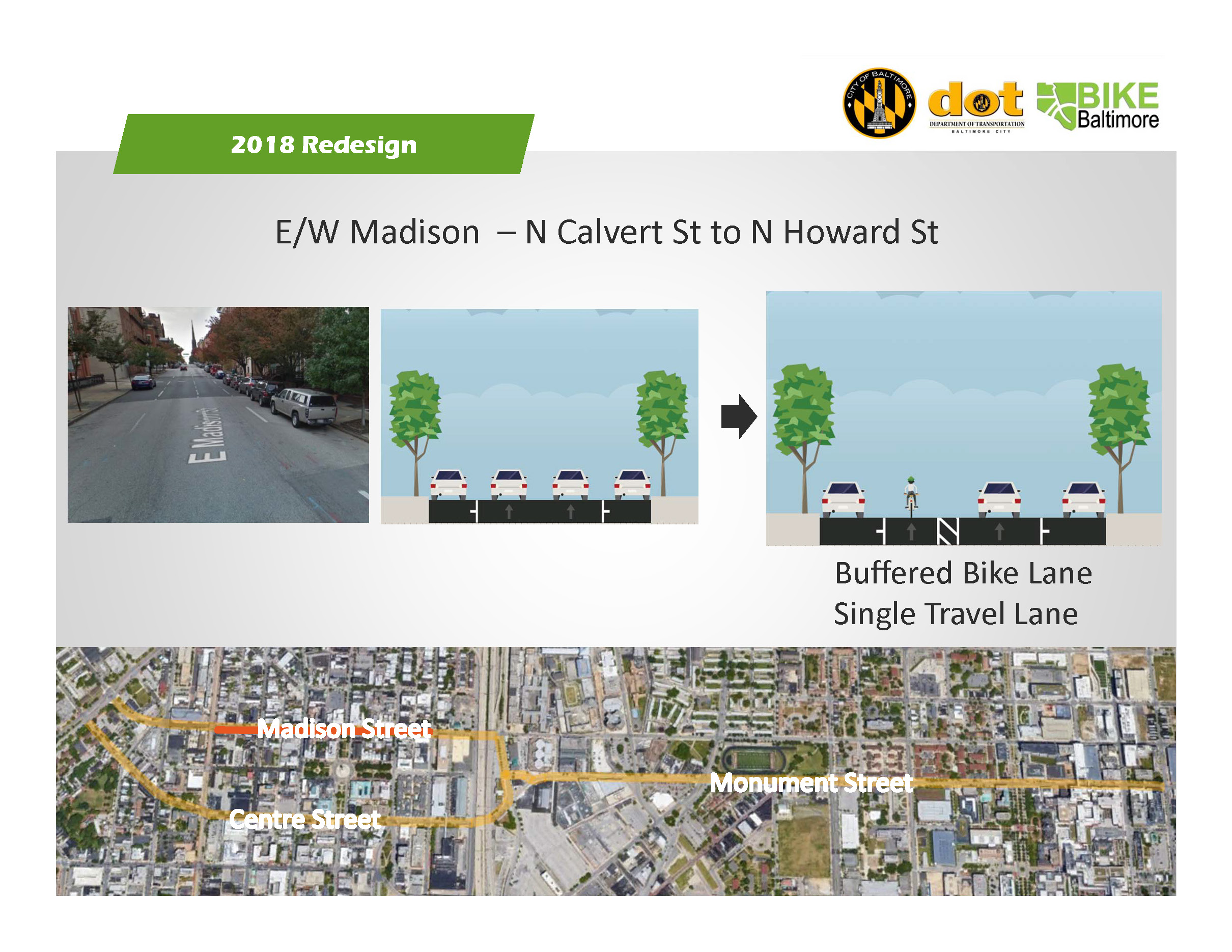
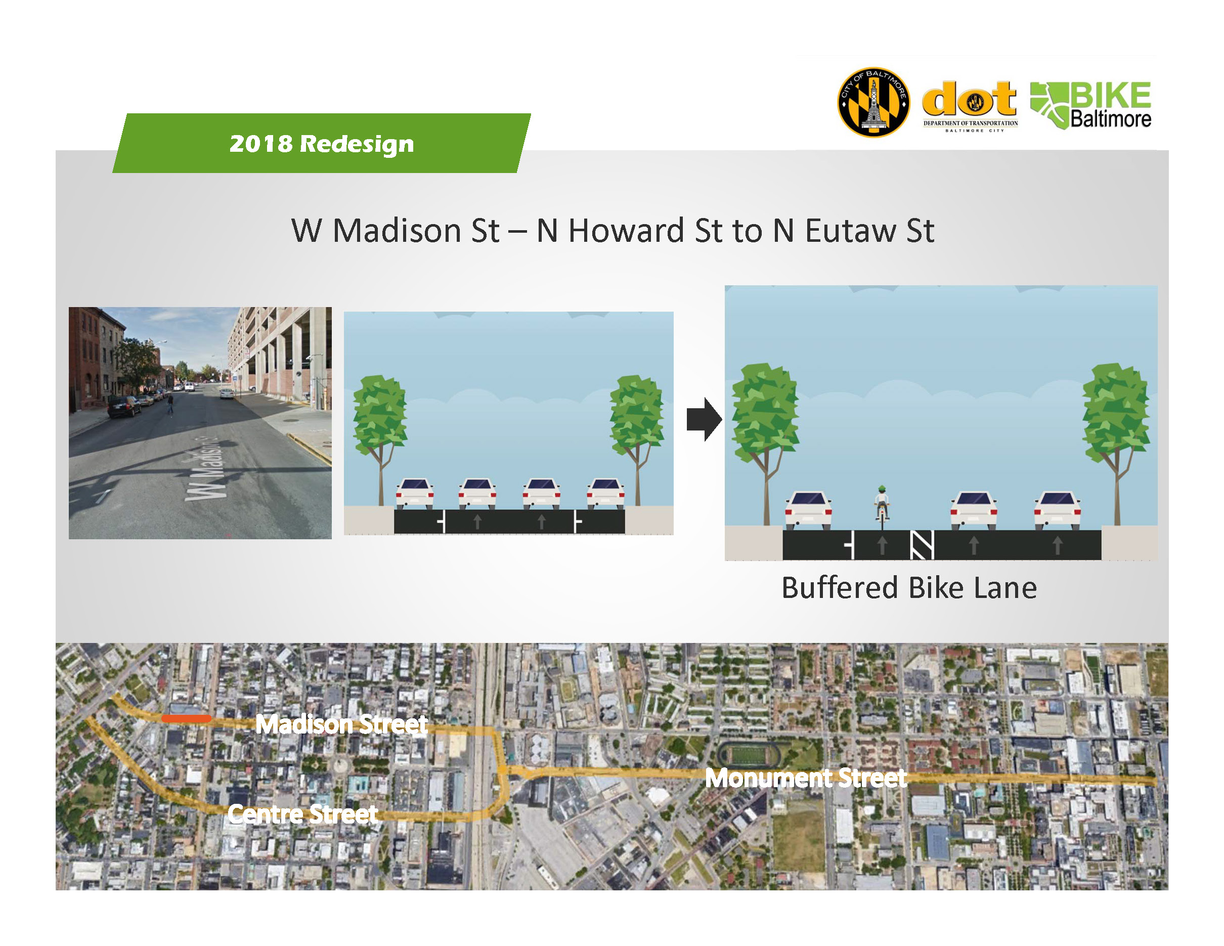
Background: Downtown Bike Network

Originally due to be installed in 2015-2016, the Downtown Bike Network included protected bike lanes on Centre Street, Madison Street, and Maryland Avenue, and standard bike lanes on Monument Street, Preston Street, and Biddle Street.

Maryland Avenue was installed, but the remainder of the network has been on a construction halt since Spring of last year due to complaints from the Baltimore City Fire Department, which is requesting 26 feet of clear street width on protected sections of the network. 

It is possible to re-design an east-west, fully-separated, all-ages facility within the Baltimore City Fire Department constraints, but it would likely remove parking.

The city has extended the construction halt as long as they can, and construction must continue this Spring or we risk losing the contract and spending significant additional resources.

As a result, we support the concept of a re-design to address Baltimore City Fire Department's unreasonable constraints, but believe whatever is installed must maintain a separated, all-ages design from project limit to project limit. 

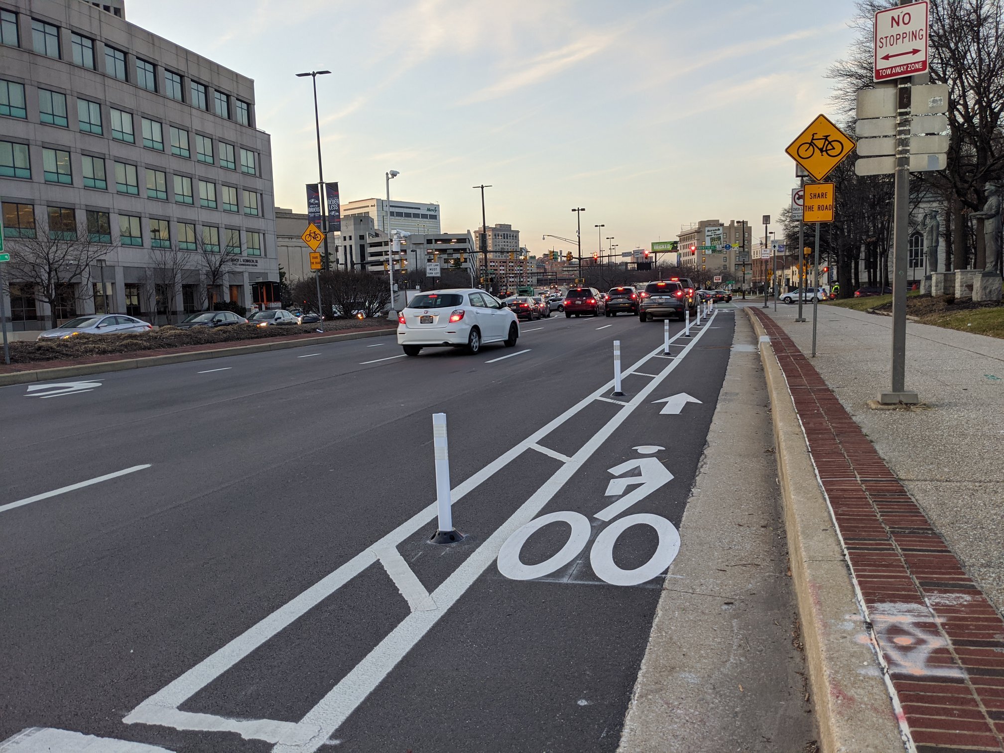
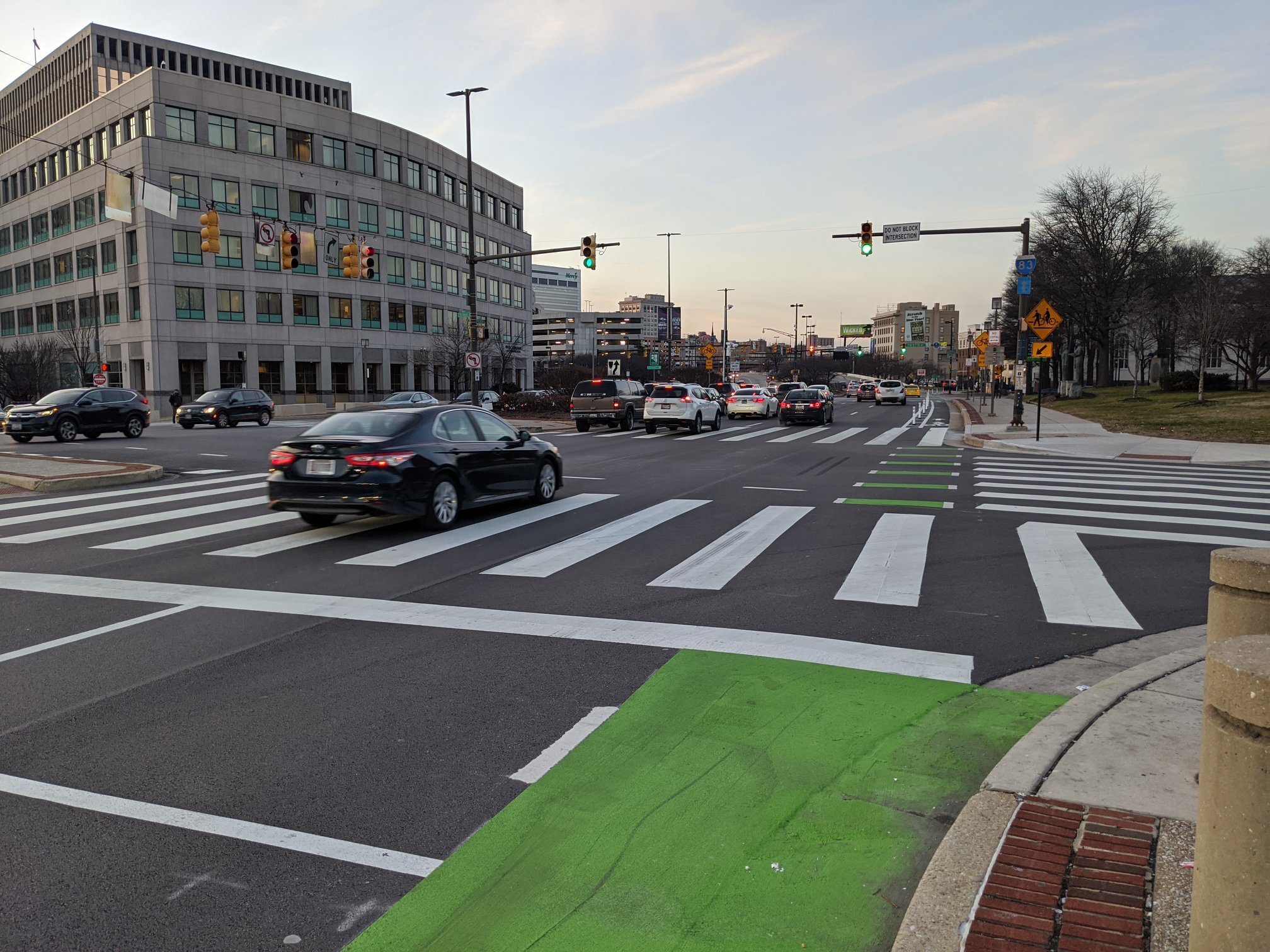
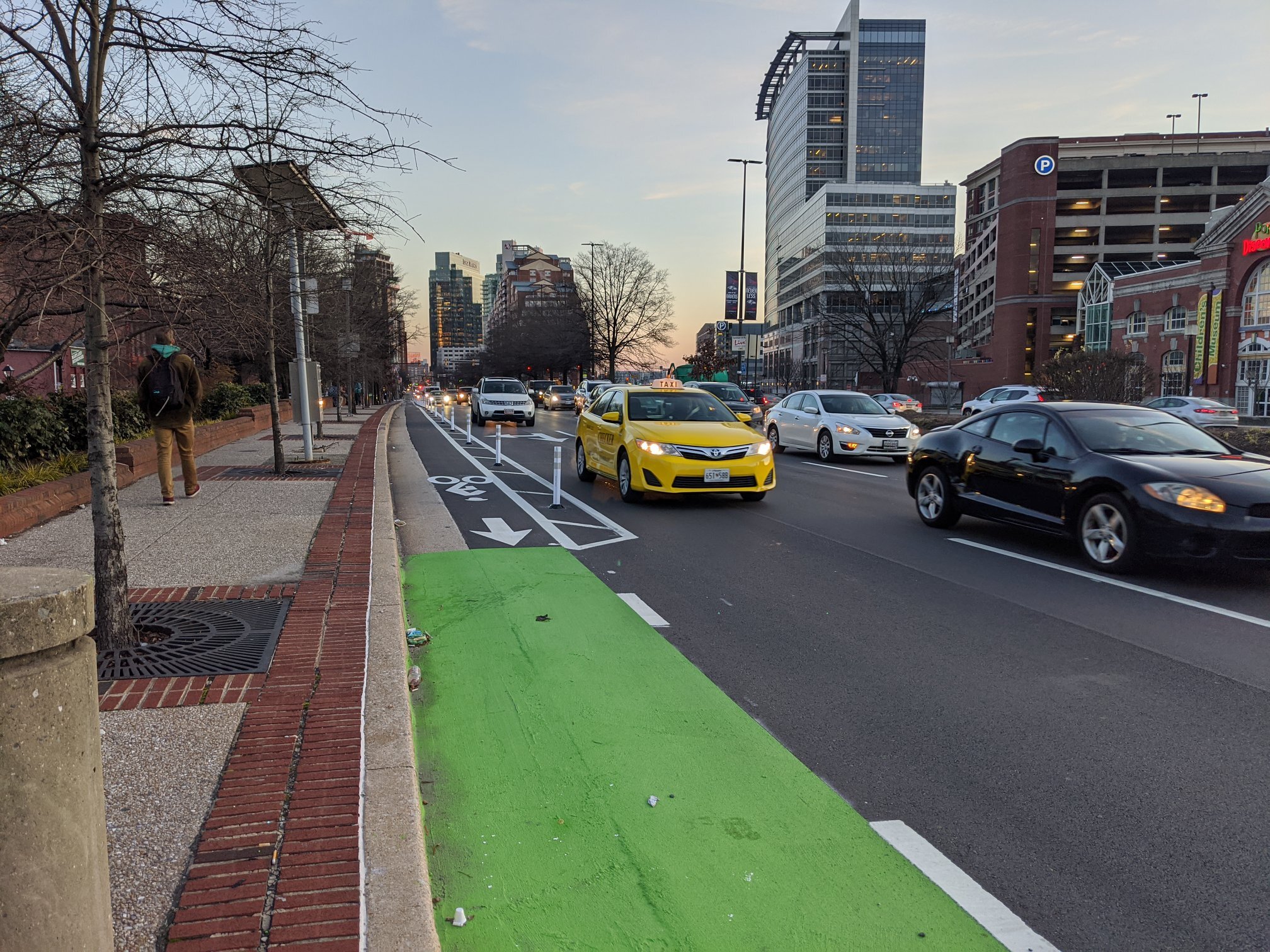
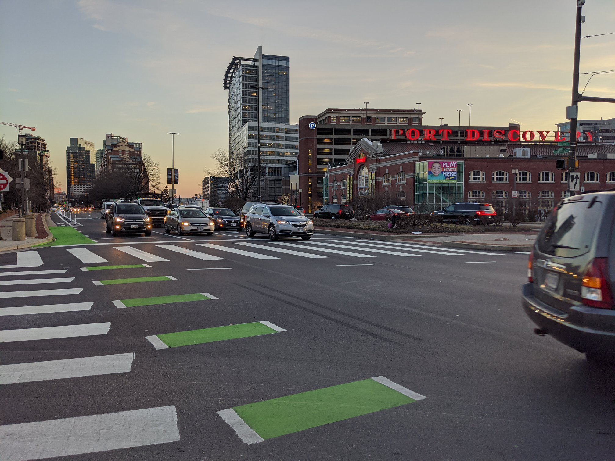
Background: Maryland Avenue

Maryland Avenue looks finished. But technically, the job hasn't been closed out. There is still some paint to be laid. As a result, it is still in limbo. Baltimore City Fire Department claims it fails to meet their fire clearance requirements. On large portions of Maryland Avenue, protection would need to be removed to meet those requirements. 

We oppose making changes to Maryland Avenue because it is a NACTO compliant, nationally recognized bike lane and because other projects that were installed during the same time period are not being threatened in a similar way. 

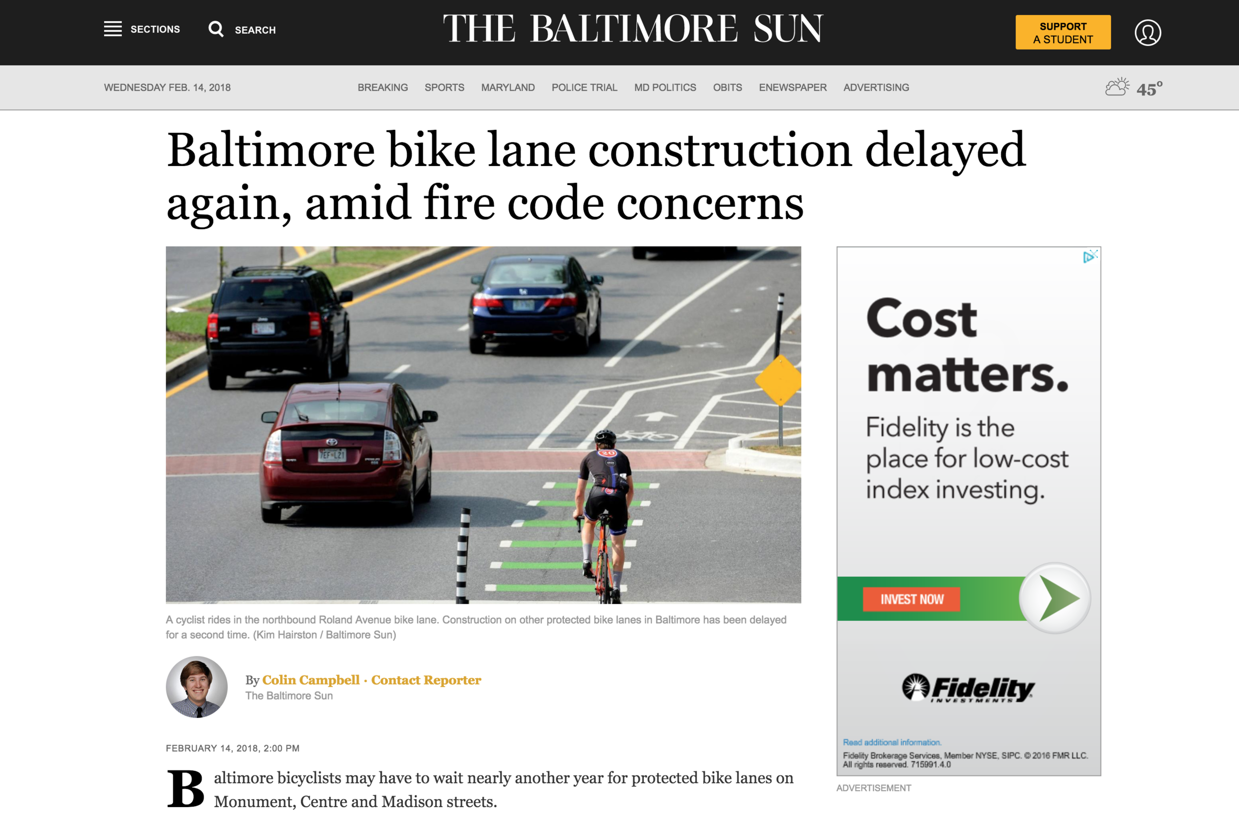
Background: Roland Avenue

Bikemore has long advocated for a road diet on Roland Avenue, reducing the street to one travel lane in each direction. This would allow for a wide parking lane and a wide, all-ages bike lane that is protected from moving traffic by parked cars. Data shows a single lane of travel is enough to accommodate the volume of traffic Roland Avenue sees every day, and that this is the best opportunity to reduce the frequency of which cars dangerously speed along the corridor. 

Baltimore City Department of Transportation opted not to pursue a road diet in their original design of Roland Avenue. As a result, the bike lane is too narrow, parking is too narrow, and the remaining two travel lanes still encourage dangerous speeding. Neighbors rightly complain about these conditions.

For the past year, Bikemore has worked alongside Roland Park Civic League and stakeholders along the corridor to advocate for changes to make Roland Avenue safer for all road users. It's clear that the only design that could address speeding cars, narrow lanes, and maintain an all-ages bike lane is a road diet that keeps the bike lane against the curb.

This option was recently presented at meeting in Roland Park, but a vocal contingent of residents is demanding that instead of a road diet, Roland Avenue should simply be returned to the original condition of two travel lanes with parking against the curb. This would solve none of the safety complaints, because it would keep two wide travel lanes for speeding cars and remove protection for people on bikes, forcing them to ride next to or in traffic with those speeding cars. Kids would no longer have a safe way to bike to school. It would be a choice to value the convenience of parking 8 feet closer to the curb over the lives of neighbors.

We support a road diet that slows down cars, widens parking lanes, and keeps a protected curbside bike lane where people of all ages can safely ride a bike.

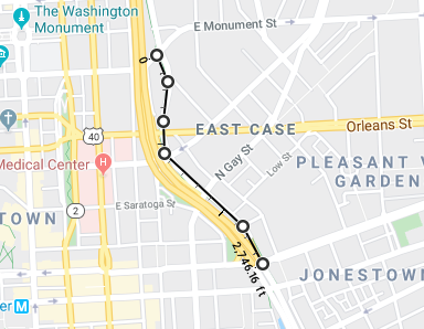
Background: Covington Street

Covington Street is another project that was beginning design when this drama began. It is still proceeding. The goal is to make a parallel all-ages biking connection to Key Highway, connecting from the soon-to-be expanded Jones Falls Trail at the Inner Harbor to Riverside Park. 

The current design is only protected adjacent to the American Visionary Art Museum. It changes to sharrows (painted bike symbols on the road) to the south. Sharrows are not bike infrastructure. They are for wayfinding. This fails the goal of an all-ages connection.

We support the extension of the protected facility or the installation of speed humps and other bicycle boulevard treatments to ensure the entire facility, especially the part in front of Digital Harbor High School, is all-ages.

Tell me about the Fire Access Issue.

When a vocal minority of neighbors began to look for ways to fight against the installation of Potomac Street, they engaged the Baltimore City Fire Department on a piece of city-adopted International Fire Code that requires 20 feet of clearance on Fire Apparatus Access Roads. 

This piece of adopted IFC had not previously been applied in street reconstruction. Other portions of city-adopted IFC require 26 feet of clearance on Aerial Fire Apparatus Access Roads (streets with buildings over 30 feet) and 26 feet of clearance on streets with fire hydrants. 

We've been assured that these rules are to be enforced on all street reconfiguration, not just street reconfigurations with bike lanes. However, we have yet to identify a piece of infrastructure without bike lanes that has been halted or threatened, and many non-compliant projects have proceeded including the Preston Gardens reconstruction that occurred over the past year which features just 12 feet of clearance adjacent to a several hundred foot tall building.

We demand that any resolution to the fire access issue be clear and fairly applied to all street reconstruction and retrofit and all new building construction and retrofit in Baltimore City per the requirements of the International Fire Code. Any resolution must encourage urban street design based on national best practices that reduce injury and death of vulnerable road users.

Fire Access issue still delaying the Downtown Bike Network

Screen Shot 2018-02-14 at 2.20.24 PM.png

This morning the city's Board of Estimates voted to approve a 318 day delay for work for the contractor hired to construct the Downtown Bike Network — again citing the fire access issue as the cause for delay. This means that the city now has until October 31, 2018 to complete work that was originally set to be completed by January 2017.

Beginning in May of 2017, there were complaints about the width of the Potomac Street bike lane which was then under construction, citing a portion of the Baltimore City adopted International Fire Code addressing the required width of streets. This code is now being applied only to streets with bike lanes, delaying construction of bike lanes that are already fully designed and funded. You can check out full story for more background on this ongoing issue. 

If less than 20 feet of clearance is truly a safety threat, the city should be applying the code to all projects, said Bikemore executive director Liz Cornish — not just those with bike lanes. “They’re not applying this interpretation of the fire code equitably for streets across the city,” Cornish said. “If it is, in fact, a safety issue, it is a safety issue on all streets.”
— Baltimore bike lane construction delayed again, amid fire code concerns, Baltimore Sun

“It’s disappointing to us that this project, which has already been subject to one extension, is already a year behind, and is now potentially behind for another year because of the fire clearance issue,” said Jed Weeks, policy director for local cycling nonprofit Bikemore.
— City Officials Again Delay Downtown Bike Network’s Installation, Baltimore Fishbowl


Want to support us in our ongoing #FightforBikes?