Bike Lanes

Harford Road Bridge Redesigned with Complete Streets Principles

Last Thursday night, Baltimore City Department of Transportation hosted a meeting with eighty community members in attendance to provide an update on the proposed design changes to the Harford Road Bridge. 

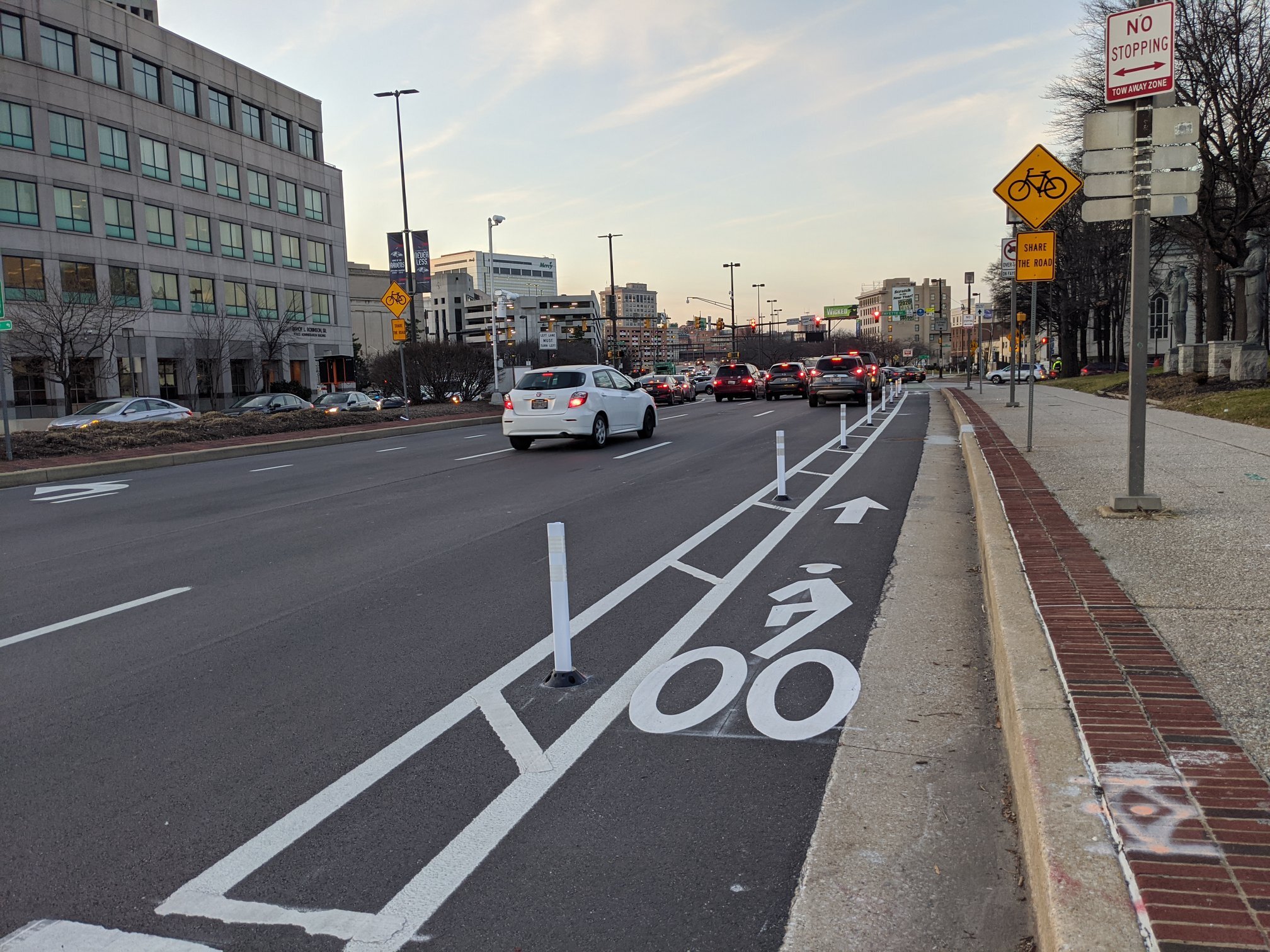
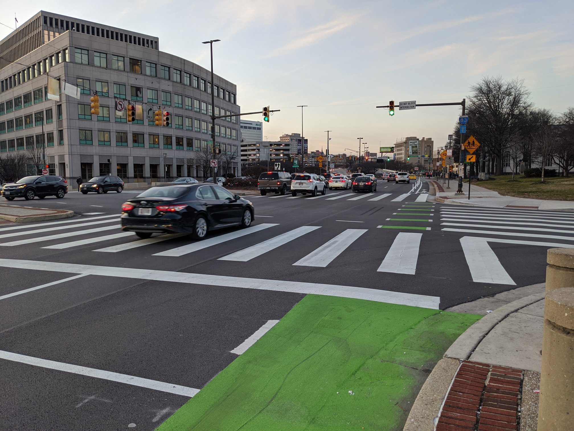
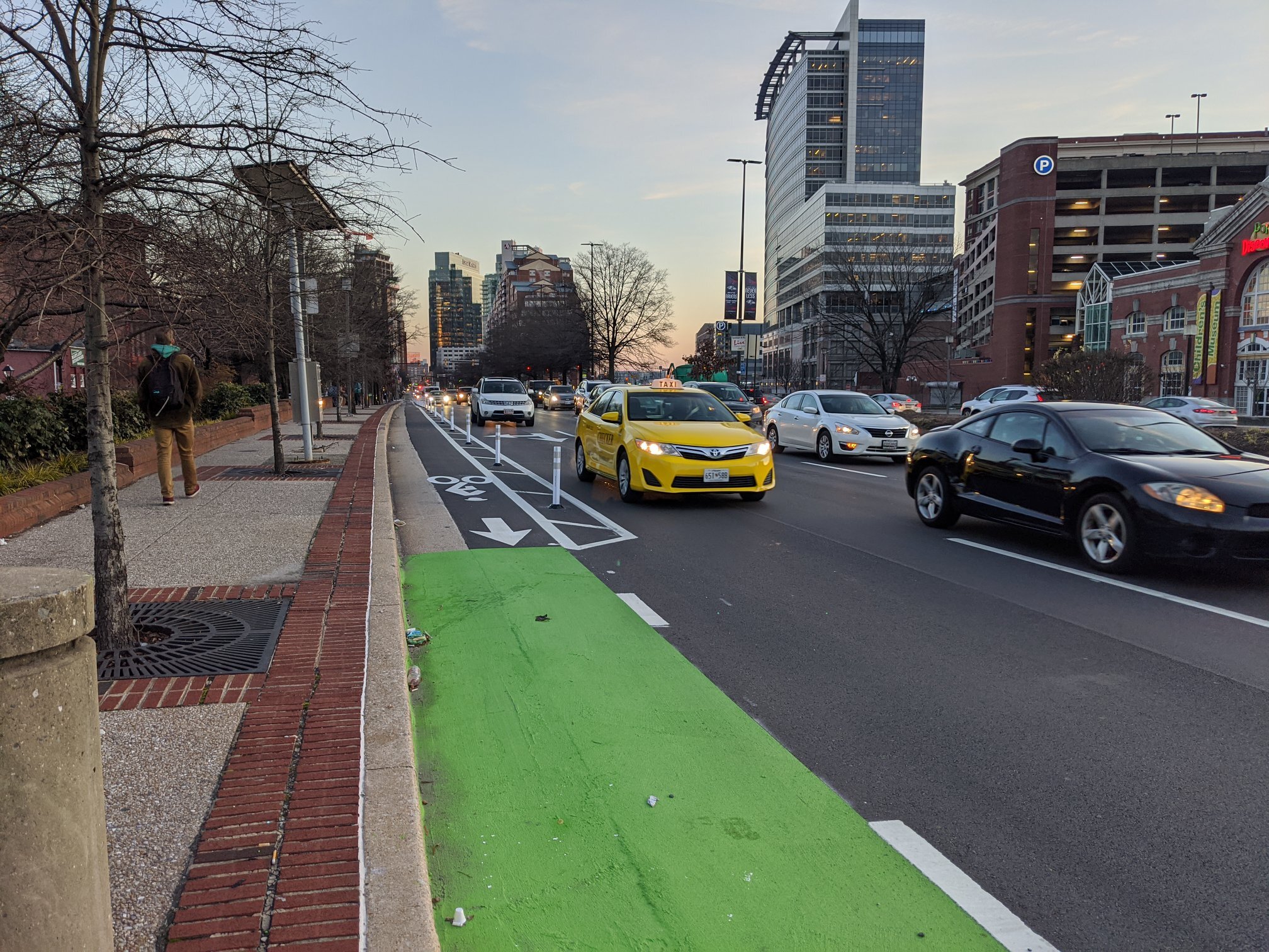
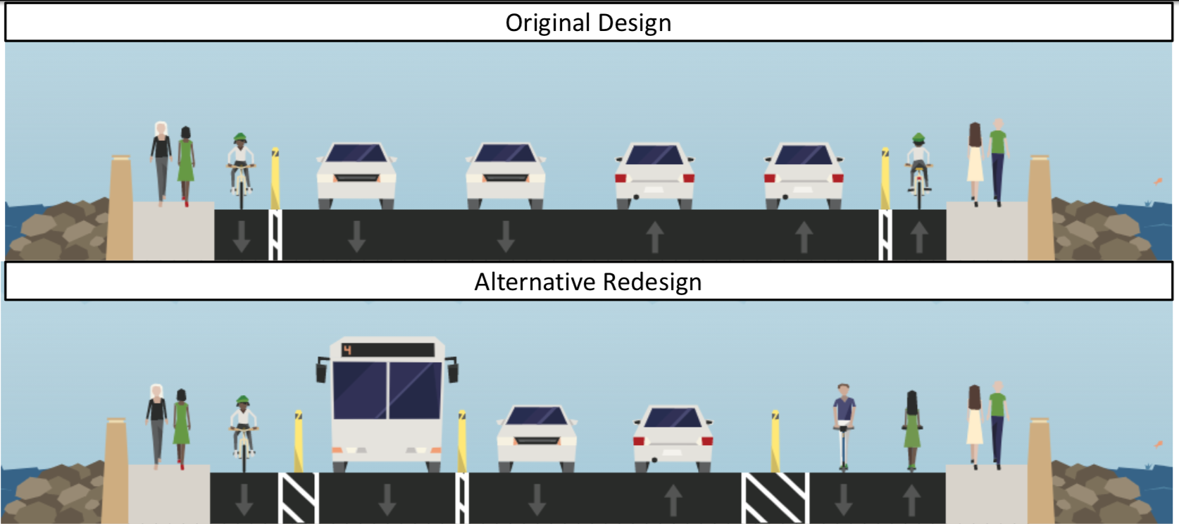
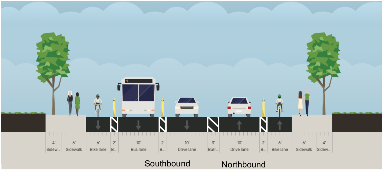
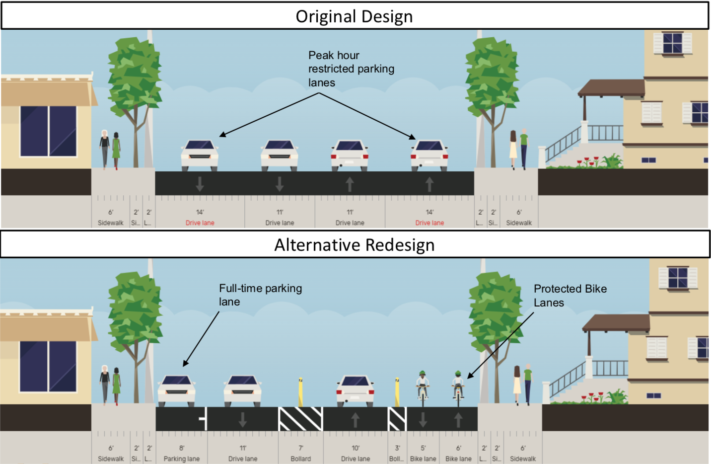
The newly proposed design reduces four lanes of car traffic to two, and reallocates this space to a southbound bus travel lane, additional lanes for mixed-use walking and biking, and more buffer between moving traffic and pedestrians. Complete Streets Manager Graham Young cited the newly adopted Complete Streets Manual and Separated Lane Network Plan as guiding documents for the new design.

The design also extends changes on Harford Road to the north and south of the bridge, reconfiguring dangerous intersections and extending separated bike lanes that make both people biking and walking on the adjacent sidewalks safer from passing cars.

Overall, folks on the call were excited about the new design and also advocated to keep Lake Montebello closed to cars and for additional closure of Walther Avenue between Harford Road and Argonne Drive.

We encourage you to view the presentation and leave comments on the proposed design here, or email dot-community@baltimorecity.gov with your comments. 

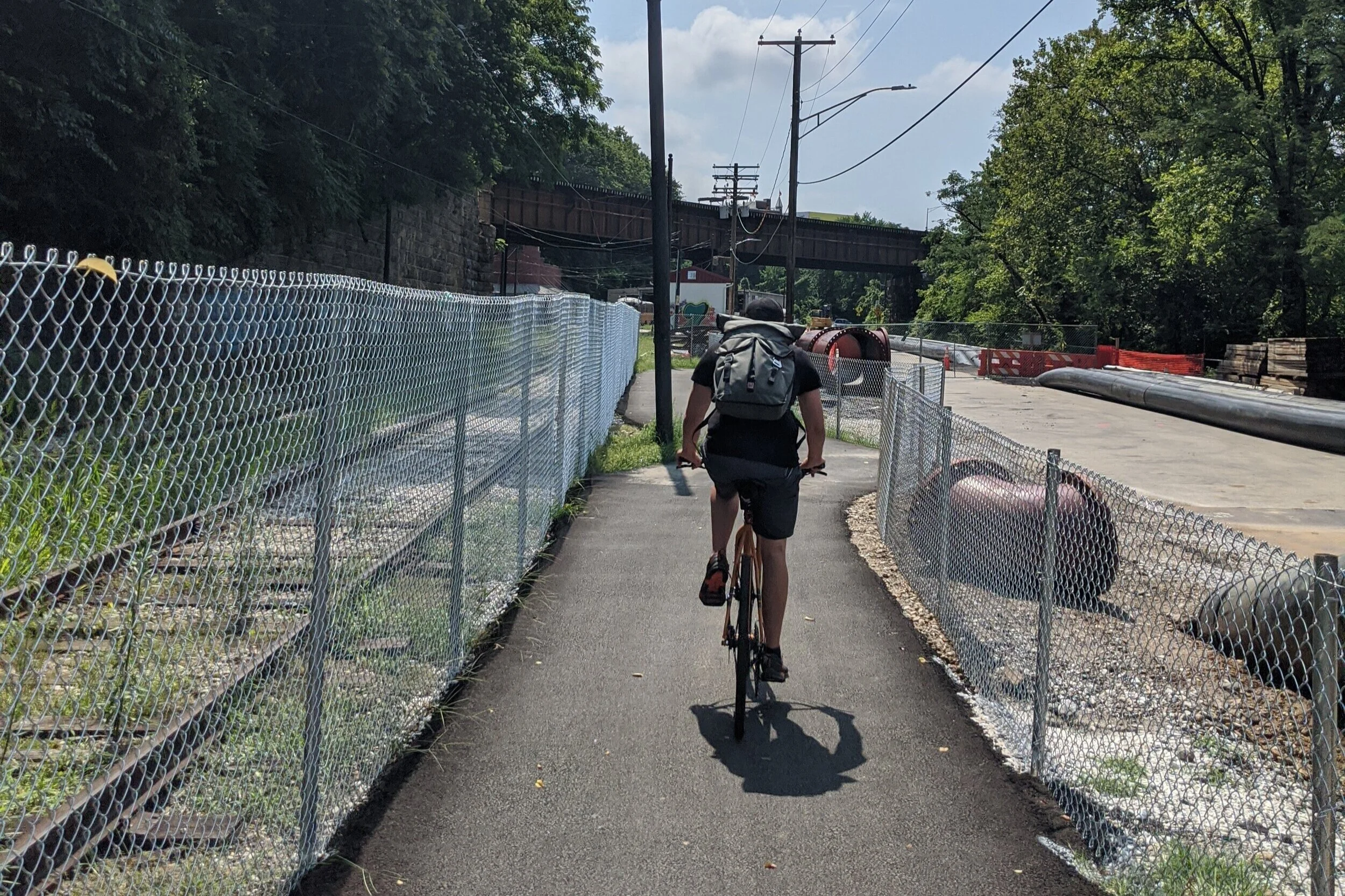
Since the Harford Road bridge has been closed, the streets to the north and south have seen less traffic and have been adjusted to accommodate space for other uses, like added parking, outdoor cafes, curb extensions, and separated bike lanes. These were long-standing community goals that existed well before the bridge project began design and construction. 

It never made sense to have a bridge design with 4 lanes of high speed car traffic and narrow, unprotected bike lanes. But that’s what the original design called for. 

From the first community meeting about the bridge, Bikemore called for a road diet and addition of separated bike lanes to the project. Neighbors complained about the high level of speeds along the current bridge, and were nervous to see the existing guardrails on the old bridge removed in the new design, because they provided basic protection to people walking across the bridge next to highway speed traffic. We were joined in calls for a re-design by then-candidate for 3rd District City Council -- Ryan Dorsey, who made changes to the bridge design a major focus of his campaign.

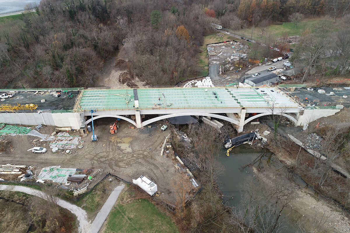
Despite Dorsey’s victory in the election, along with broad community support for design changes and Bikemore’s advocacy, no substantial changes were made from the original bridge design presented. In 2018, the bridge project moved to construction. As reported at the time in the Baltimore Sun:

City Councilman Ryan Dorsey, who represents the area and runs a Facebook page dedicated to news about the bridge, criticized the new bridge’s design as “incredibly unsafe” because the bike lane is not physically separated by barriers from the road, he said.

If it had been designed in Montgomery County, Dorsey said, a separated bike lane would be required due to traffic volumes and observed speeds.

“It’s really a failing of DOT that a safer design was not planned from the outset, even worse that safer design was called for by community members from the earliest stages, but DOT insisted on this unsafe design,” Dorsey said. “This DOT has not really inspired much confidence so far, but I’m still holding out hope that a change will be made before we get to a point where it’s really too late.”

Over the past 15 years, the city transportation department has ignored calls from residents, advocates and public officials to build a new bridge that is safe and accessible for pedestrians and bicyclists, said Jed Weeks, policy director of Bikemore, a bicycle advocacy group.

“Instead, they've doomed generations of Baltimoreans to an unsafe design with minimum width sidewalks and unprotected bike lanes next to speeding traffic,” Weeks said in a statement. “This bridge is a total failure in planning and an example of why we had to pass an ordinance to force BCDOT to do better in the future."

While the beginning of construction marked the end of advocacy for a smaller bridge design that could have saved millions of dollars in construction costs, we continued to advocate for an improved reconfiguration of the wide bridge that was to be built. In that time, we gained new leadership in the mayor’s office, new leadership at BCDOT, and Councilman Dorsey was re-elected, cementing that there is broad support for his complete streets vision within the 3rd District.

This redesign, combined with the closure of Lake Montebello to car traffic, the coming design and installation of trail along St. Lo Drive and 33rd Street, and future expanded separated bike lanes along Harford Road are a culmination of years of advocacy that would not have been possible without Bikemore’s supporters.

#FillTheRoom at Upcoming BCDOT Meetings

This Thursday, Baltimore City Department of Transportation (BCDOT) is hosting two meetings that will affect bicycle infrastructure connectivity. Bikemore staff will be joining to hear updates and provide input on equitable design. We hope you can come too, especially if you’re a resident of the areas where the infrastructure will be built.

Harford Road Bridge Meeting 

Thursday, January 21 | 6pm | On WebEx

Construction on the Harford Road Bridge over Herring Run began in 2018. The original design for the bridge included standard bike lanes next to four lanes of high-speed traffic, despite widespread community requests for the new design to slow down cars and provide safer space for biking and walking. 

We have been advocating alongside District 3 Councilman Ryan Dorsey for a Complete Streets redesign of the bridge that includes space in which people of all ages feel comfortable walking and biking. BCDOT will provide updates on the design changes under consideration during this meeting.

Details + Meeting Link

Wolfe/Washington Cycle Track Meeting

Thursday, January 21 | 6pm | On WebEx

As part of the Separated Lane Network Plan released in 2016, a North/South connecting separated bike lane is planned to be built on either Wolfe St. or Washington St. This meeting will kickoff discussion on a design and selection of which street would serve as the best connection.

A separated bike lane on Wolfe/Washington St. would be a critical route through East Baltimore for people of all ages and abilities to feel comfortable using. It would connect the Promenade and Monument Street for East/West travel and to a planned trail connection on St. Lo Drive that would provide access through Clifton Park to future separated lanes on Harford Road and the future Baltimore Greenway Trail Network on 33rd Street and Herring Run.

Details + RSVP (Required)


If you are able to join and show your support for biking and walking infrastructure on these corridors, please sign on to fill the virtual room. 

Have questions? Feel free to email us at info@bikemore.net

Big Jump Detour for Druid Hill Reservoir Construction

BigJumpWeb_51_1G7A2050.jpg

Background

The ongoing Department of Public Works construction project in Druid Hill Park to install tanks to store treated city drinking water is moving to a phase of pipe construction to connect the two tanks our water system. The pipe will cross Druid Park Lake Drive at Linden Avenue, and follow the roadway along the median east to the JFX on-ramps. To make this connection, DPW will need to dig a trench in the median of Druid Park Lake Drive.

In between the original plans for this construction and today, Baltimore City Department of Transportation received a grant from People For Bikes called The Big Jump, to install a temporary shared use pathway along Druid Park Lake Drive and across the 28th Street bridge, a road diet and protected bike lanes on Huntingdon Avenue and 25th Street, a bike boulevard on 27th Street, and bike lanes on Remington Avenue.

Of those grant funded projects, only the most important one—the connection across Druid Park Lake Drive and the 28th Street bridge—has been constructed. The shared use path, installed in June 2018, allows people to walk, bike, skate, and use a wheelchair or mobility device to safely cross from Reservoir Hill to Remington for the first time.

The Detour

The trench work for the Druid Hill Reservoir will require detour of The Big Jump for approximately one year, and work will begin as soon as September 28, 2020. Motor vehicle traffic will move to the existing travel lane utilized by The Big Jump from Linden Avenue to the Mount Royal Avenue slip lane. Water filled barriers along this portion of roadway will be replaced with concrete barriers. The Big Jump will be relocated to an adjacent 8 foot sidewalk, which DOT is working to clear of weeds and debris.

The existing Big Jump route is shown in red. The detour route is shown in green.

The existing Big Jump route is shown in red. The detour route is shown in green.

The Big Jump will follow an 8 foot sidewalk from Linden Avenue to Lakeview Avenue. DOT is working to mow and clear debris.

The Big Jump will follow an 8 foot sidewalk from Linden Avenue to Lakeview Avenue. DOT is working to mow and clear debris.

At Lakeview Avenue, The Big Jump will move to the northern side of the street adjacent to Lakeview Towers, repurposing an existing parking lane. It will then cross over to the existing pathway on the 28th Street bridge through a newly created curb cut underneath the existing non-ADA accessible pedestrian overpass from Druid Park Lake Drive to 28th Street. To facilitate safe crossing at this location, the Mount Royal slip lane will be closed to motor vehicle traffic with physical barriers—a huge safety improvement.

The Big Jump detour from Lakeview Avenue past the Lakeview Towers to the Mount Royal slip lane.

The Big Jump detour from Lakeview Avenue past the Lakeview Towers to the Mount Royal slip lane.

The Big Jump detour will connect back to the original Big Jump path through the Mount Royal slip lane, which will be closed to motor vehicle traffic.

The Big Jump detour will connect back to the original Big Jump path through the Mount Royal slip lane, which will be closed to motor vehicle traffic.

What’s next

While the sidewalk element of this detour is not ideal, there are very encouraging opportunities that the trench work unlocks. Since the existing water filled barriers are being replaced with concrete barriers through the duration of the detour, it’s possible we could keep the concrete barriers in place when The Big Jump returns to the street, improving safety and reducing maintenance. It’s also possible to reconfigure and resurface the motor vehicle travel lanes along Druid Park Lake Drive. This will further reinforce The Big Jump as a semi-permanent pathway.

Also coming up is the release of the Big Jump evaluation report. It’s exciting in that it reveals The Big Jump had almost no effect on traffic conditions—one of the major vocal complaints from drivers.

Long-term, Baltimore City Department of Transportation has committed to a corridor realignment study to propose a complete redesign or removal of the highways that separate Druid Hill Park from communities. None of this work would have been possible without community partners and the leadership of Councilman Leon Pinkett. Neighbors and advocates are organizing around the corridor realignment study under the banner of The Access Project: Druid Hill Park. You can read more at TAP Druid Hill.

Detours Done Well

In the infrastructure world, it’s called “Maintenance of Traffic.” Really, it’s just a detour. And traditionally, it’s something that’s been awful in Baltimore.

We’ve all experienced it. You’re riding down a protected bike lane, and suddenly there’s construction blocking the lane and nowhere for you to go. Or you’re walking down a sidewalk and suddenly there’s a sign that says “sidewalk closed, use other side” but no crosswalk or curb cut to get you there.

It’s against the law to do this. Baltimore City Department of Transportation has Maintenance of Traffic regulations for contractors that require them to provide a safe detour around construction that closes sidewalks and bike lanes. This usually means closing the adjacent car parking or travel lane to allow pedestrians or bicyclists to use it to go around the construction. But in practice, this rarely happens. Instead, we see dangerous closures like this:

Baltimore City Department of Transportation needs more and better trained inspectors to regularly issue fines for this kind of illegal, dangerous work. And, our city needs to aggressively collect those fines from some of our biggest offenders. The agency is working on a new street cuts manual, and we have advocated for increased fines and more diligent inspections, as well as for the additional resources the agency needs to follow through.

But we also wanted to use this post to show some examples of great maintenance of traffic implementations—exactly the kind of work that contractors should be doing and Baltimore City Department of Transportation should be demanding.

The first is the utility work along the Jones Falls Trail on Falls Road by the Baltimore Streetcar Museum. On prior trail-adjacent projects like the Druid Hill Reservoir tank construction and the Edmondson Avenue bridge replacement, trails were and continue to be closed without detour for years. Contrast that failure with Falls Road, where the street was closed to car traffic and a detour was created to ensure the Jones Falls Trail remains accessible:

Falls Road Maintenance of Traffic

Falls Road Maintenance of Traffic

Another recent example is the Harbor Promenade closure for construction by Aliceanna and Wolfe Streets. In the past, the promenade has been closed for construction without adequate detours. At first, this closure looked like it would be a similar situation. But thanks to advocacy from neighbors, community associations, Councilman Zeke Cohen, and Delegate Brooke Lierman, a high quality, physically separated detour was put in place along Aliceanna Street for people biking, walking, and rolling.

Aliceanna Maintenance of Traffic

Aliceanna Maintenance of Traffic

We’re happy to see great examples of proper, safe detours adjacent to construction being implemented in Baltimore City, as the law requires. And, we will continue to advocate for more resources for Baltimore City Department of Transportation so they can adequately enforce quality work in our roadways.

President Street Bike Lane Improvements

The Baltimore Complete Streets ordinance requires Baltimore City Department of Transportation to retrofit improved walking, biking, and transit infrastructure onto streets during routine resurfacing.

President Street began resurfacing prior to the ordinance taking effect, but BCDOT was able to make some last minute changes in the design to add high visibility crosswalks and a flex post buffer to the previous substandard bike lane.

While President Street is still far from a safe, all-ages street, we are thankful for these improvements. We will continue to advocate for BCDOT to extend this separated treatment up Fallsway, creating a more visible and safer Jones Falls Trail while connecting to existing protected bike lanes on Centre and Monument Streets.