Policy

Bikemore Statement About Street Attacks

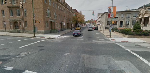
As we posted earlier today, another person was attacked while riding his bicycle this past weekend on Guilford Avenue in Greenmount West. Attacks like this have been reported sporadically over the past few years  not just on people riding bicycles, but people walking as well  usually along Guilford Avenue and Charles Street between Mount Royal Avenue and 25th Street.

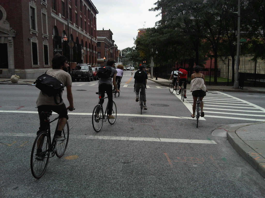
These incidents do not represent the actions of all Baltimore City youth. Many City youth ride bikes for transportation or otherwise get around Baltimore peacefully, and many engage in positive after-school bicycle activities like the Baltimore Bike Experience at Digital Harbor High School and Baltimore Bike Party.

The only way to know what motivated the specific group of youth who appear on the video is to ask them, but we suspect that if Baltimore had more productive adult supervision and more safe places for youth to learn and engage in positive activities, this incident would not have occurred.

Obviously, there must be consequences for assaulting another human being, but we should also use this unfortunate event as an opportunity to teach young people the impact of their actions and address the underlying causes of the assault.

Bikemore is actively engaging with the police and community leaders to ensure the neighborhoods along the Guilford Avenue Bike Boulevard are safe for commuters and residents alike, regardless of one's chosen mode of transportation. We hope this incident promotes a constructive dialogue about increased after-school and evening opportunities for youth in our city.

If you would like to be part of this dialogue, please feel free to contact us.

Bikemore’s Recommendations for the Downtown Bicycle Network

The Baltimore City Department of Transportation (BCDOT) has committed $3 million in 2014 to build a series of bicycle infrastructure projects collectively known as the Downtown Bicycle Network. We offer the following recommendations, based on BCDOT’s presentation of February 4, in the spirit of constructive input and ongoing collaboration. A letter nearly identical to this post was sent via email and snail mail to BCDOT leaders on March 27, 2014.

In this post, “Maryland Avenue Cycletrack” refers to the entire protected bicycle lane along Maryland Avenue, Cathedral Street, Liberty Street, and Hopkins Place between 29th Street and Pratt Street, while “Downtown Bicycle Network” refers to the Maryland Avenue Cycletrack plus proposed standard bicycle lanes on Centre, Madison, Monument, Biddle, Preston, and Dolphin Streets.

The proposed Downtown Bicycle Network to be constructed in 2014, plus the Mount Royal Avenue Cycletrack and the Guilford Avenue bicycle lane.

The proposed Downtown Bicycle Network to be constructed in 2014, plus the Mount Royal Avenue Cycletrack and the Guilford Avenue bicycle lane.

Assuming that, in the short term, pedestrian crossing signals are to be used as bicycle crossing signals along the Maryland Avenue Cycletrack corridor instead of bicycle-specific signals, BCDOT should install pedestrian crossing signals at every signalized intersection along the corridor that is currently missing any pedestrian crossing signals. If it were built today, northbound bicycle traffic at several intersections along the corridor would not have a clear signal of when to proceed without a pedestrian crossing signal.

Signalized intersection without pedestrian crossing signal at Maryland Avenue at 27th Street.

Signalized intersection without pedestrian crossing signal at Maryland Avenue at 27th Street.

Add a 5-second leading interval for all bicycle/pedestrian signals and ban all turns on red in every direction at each signalized intersection that the Downtown Bicycle Network touches:

  • Maryland Avenue / Cathedral Street / Liberty Street / Hopkins Place at Pratt, Lombard, Baltimore, Fayette, Lexington, Saratoga, Mulberry, Franklin, Centre, Monument, Mount Vernon Place, Madison Street, Read, Eager, Chase, Biddle, Preston, Mount Royal, Oliver, Lanvale, Lafayette, North Avenue, 20th, 23rd, 24th, 25th, 27th, 28th, and 29th

  • Dolphin Street at Fremont, Myrtle, Pennsylvania, Druid Hill Ave, McCulloh, Madison Avenue, Eutaw, and Howard

  • Preston Street at Cathedral, Maryland, Charles, Saint Paul, Calvert, Guilford, Greenmount, Ensor, Aisquith, Harford, Central, Caroline, Broadway, Wolfe, and Washington

  • Biddle Street at Cathedral, Maryland, Charles, Saint Paul, Calvert, Guilford, Greenmount, Ensor, Aisquith, Harford, Central, Caroline, Broadway, Wolfe, and Washington

  • Madison Street at Paca, Eutaw, Howard, Park, Cathedral, Charles, Saint Paul, Calvert, Guilford, Fallsway, Greenmount, Ensor, Aisquith, Harford, Central, Caroline, Broadway, Wolfe, and Washington

  • Centre Street at Paca, Eutaw, Howard, Park, Cathedral, Charles, Saint Paul, Calvert, Guilford, and Fallsway

  • Monument Street at Greenmount, Ensor, Aisquith, Harford, Central, Caroline, Broadway, Wolfe, and Washington

  • Guilford Avenue at Pratt, Lombard, Baltimore, Fayette, Lexington, Saratoga, Mulberry, Franklin, Centre, Monument, Mount Vernon Place, Madison Street, Read, Eager, Chase, Biddle, Preston, and Mount Royal

This means that people on foot and on bicycles get a 5-second head start at every intersection, thus increasing their visibility and calming traffic by reducing potentially aggressive maneuvers from people in motor vehicles stopped at red lights. For example, as shown in the image below, a left turn on red is presently allowed from westbound Preston Street onto southbound Maryland Avenue; people in cars trying to make a left turn on red will be looking to their right for southbound car traffic here, which means they are less likely to see people on bicycles traveling northbound on the Maryland Avenue Cycletrack. Banning all turns on red would simply reduce the amount of things that people on foot and on bicycles would need to worry about.

Facing west on Preston Street at Maryland Avenue.

Facing west on Preston Street at Maryland Avenue.

An existing leading pedestrian interval at Pratt and Light Streets.

An existing leading pedestrian interval at Pratt and Light Streets.

Extend the Maryland Avenue Cycletrack from Hopkins Place across Pratt Street and along the east side of Sharp Street under the Convention Center, and create a high-quality connection across Conway Street to Sharp Street.

This view, looking north from Sharp Street across Pratt Street to Hopkins Place, shows in red the route that an extended Cycletrack should take.

This view, looking north from Sharp Street across Pratt Street to Hopkins Place, shows in red the route that an extended Cycletrack should take.

Install wayfinding signage at major bicycle intersections:

  • Maryland Avenue / Cathedral Street / Liberty Street / Hopkins Place at 27th Street, 24th Street, Jones Falls Trail, Oliver, Biddle, Preston, Madison Street, Centre, Lombard, and Pratt

  • Dolphin Street at Pennsylvania, Druid Hill Ave, McCulloh, Madison Avenue, and Eutaw

  • Preston Street at Maryland, Guilford, Central, Caroline, Broadway, Wolfe, and Washington

  • Biddle Street at Maryland, Guilford, Central, Caroline, Broadway, Wolfe, and Washington

  • Madison Street at Eutaw, Park, Cathedral, Guilford, Fallsway, Central, Caroline, Broadway, Wolfe, and Washington

  • Centre Street at Eutaw, Park, Cathedral, Guilford, and Fallsway

  • Monument Street at Central, Caroline, Broadway, Wolfe, and Washington

  • Guilford Avenue / South Street at Pratt, Lombard, Centre, Madison Street, Chase, Biddle, Preston, and Mount Royal

Existing bicycle wayfinding signage on Guilford Avenue (photo courtesy of BCDOT).

Existing bicycle wayfinding signage on Guilford Avenue (photo courtesy of BCDOT).

Increase the door zone buffer to three (3) feet along the entire Maryland Avenue Cycletrack corridor. Three feet is the NACTO Design Guide standard for door zone buffer width, and the Cycletrack plans currently only call for two feet. The door zone buffer delineates the space where people should not ride because of opening car doors.

A 3-foot buffer on the 15th Street Cycletrack in Washington, D.C., cited by BCDOT as a model for the Maryland Avenue Cycletrack.

A 3-foot buffer on the 15th Street Cycletrack in Washington, D.C., cited by BCDOT as a model for the Maryland Avenue Cycletrack.

Install a reflective bollard at the north side of each block along the Maryland Avenue Cycletrack corridor so that southbound automotive traffic cannot enter the bicycle lane.

Cycletrack in Vancouver with bollard. Photo courtesy of velotraffic.com.

Cycletrack in Vancouver with bollard. Photo courtesy of velotraffic.com.

Install traffic separators on the door zone buffer along the full Maryland Avenue Cycletrack corridor to increase the awareness and feeling of separation and to simulate curb for parallel parking.

Traffic separators on a bicycle lane in Barcelona. Photo courtesy of pedalforward.blogspot.com.

Traffic separators on a bicycle lane in Barcelona. Photo courtesy of pedalforward.blogspot.com.

Volunteer for the September Baltimore Bike Counts

Photo Credit:  Liam Quigley It's no secret to any of us that cycling is on the rise in Baltimore, and it is important to quantify the uptick so it can turn into good policy and infrastructure. To that end, the latest batch of bike counts are coming in this month on September 24-26. Like always, volunteers are needed to man different counting stations across the city.

If you can spare a few hours in the morning or evening on any of those days, it would go a long way.

The sign-up form is over at B'more Bikes. Sign up now!

Results of the Bike & Pedestrian Master Plan Survey

Bicycle and Pedestrian Master Plan Findings

Bicycle and Pedestrian Master Plan Findings

Recently, the DOT asked cyclists and pedestrians to take part in a survey for its Bike & Pedestrian Master Plan.  Well, the votes are in, and some of the findings are below.  For more results, head over to the MDOT site and click on the reports tab, and you'll find the extensive report.

The top reasons survey respondents cited for investing in bicycle and pedestrian improvements included:

  • Improving the safety of walking and biking

  • Creating safe routes for walking and biking to schools

  • Increasing physical health and activity

The top obstacles to walking reported in the survey results were:

  • Pedestrian facilities such as sidewalks and paths are missing or bad

  • Traffic is too fast or heavy

  • The need to transport people or things

The top obstacles to biking reported in the survey results were:

  • Motorists don’t exercise caution around cyclists

  • Lack of or poor condition of bike facilities

  • Traffic is too fast and heavy

The top priority objectives identified in the straw poll results were:

  • Address gaps and physical barriers in the bicycle network; build connected networks with continuous bicycle accommodations.

  • Address key gaps in trail systems and improve integration of trails and on‐road facilities.

  • Provide assistance and/or incentives to local governments to improve biking and walking.

  • Incorporate Complete Streets principles in all State transportation projects, and promote Complete Streets policies at the local level.

  • Promote bicycling and walking as normal transportation modes that have a broad diversity of participants.

  • Focus on improving bicycling and walking conditions in locations with the highest demand.