West Baltimore Bike Boulevards Project Update

The West Baltimore Bike Boulevard project is funded and designed, with construction planned this coming Spring. This project began the planning, design, and community input process several years ago, and like the Downtown Bike Network, the construction start date is long overdue but finally approaching.

What is a Bike Boulevard?

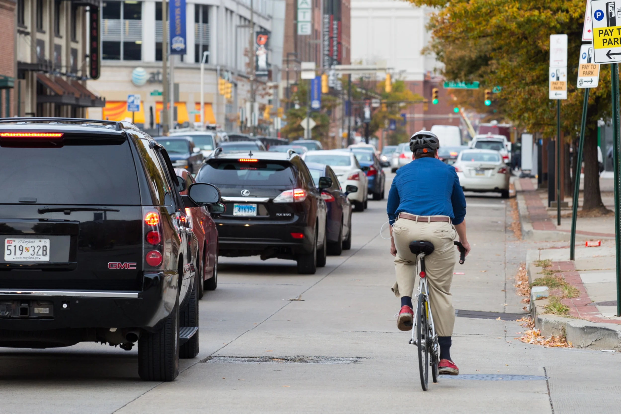
Bike Boulevards are neighborhood streets that have been prioritized as bicycle routes through changes in street design. These changes are designed in a way to force cars to drive slowly and more carefully, while allowing people on foot or bike to use the road comfortably and safely.

The West Baltimore Bike Boulevards will incorporate bike-friendly speed humps, mini traffic circles, contraflow bike lanes, bike boxes and advance stop bars, as well as neighborhood cut-throughs to prioritize safe, convenient bike travel. Click on some of the images below for examples of these treatments.

Bike Boulevards are ideal for neighborhood streets with traffic volumes or speeds low enough that protected, separate bike lanes aren't necessary. An example of a bike boulevard in Baltimore is Guilford Avenue between Mount Royal and 33rd Streets. When installed, bicycle traffic increased significantly on this corridor.

West Baltimore Bike Boulevards

The West Baltimore Bike Boulevards project installs bicycle boulevards to connect to existing "low-stress" (easy to bike on) streets in the neighborhoods of Franklin Square, Midtown Edmondson, Harlem Park, Poppleton, Sandtown, Union Square, and Hollins Market.

These neighborhoods have been severed for decades by the Route 40 "Highway to Nowhere" which demolished major sections of predominantly African-American neighborhoods for an ill-conceived highway expansion through West Baltimore.

Beyond that obvious barrier to neighborhood connectivity in the project area, there are other significant barriers to opportunity. 55% of households in the project area earn less than $25,000 annually. The majority of the project area's population is of working age, but unemployment is high and job opportunities are few and far between. In many parts of the project area, 80% or more of households lack access to a car.

The bicycle boulevards would have connected these neighborhoods via safe, comfortable bicycle infrastructure to the Baltimore Red Line and the West Baltimore MARC station, providing direct access to a major transit line and the related jobs and access to opportunity it would bring.

Governor Hogan's devastating cancellation of the Baltimore Red Line removed one major connection to this project, but there are numerous other reasons why construction is beneficial, including neighborhood connections to:

  • West Baltimore MARC Station

  • Future West Baltimore BaltimoreLink Transit Center

  • Lafayette Square Park

  • Harlem Square Park

  • Franklin Square Park

  • Union Square Park

  • Bon Secours Hospital

  • James McHenry Recreation Center

  • Hollins Market

  • B&O Museum and Rail Yard

  • Mount Clare Junction Shopping Center

Baltimore Bike Share will launch in the project area during installation of the bike boulevards. Bike Share is successful when it is directly connected to "low-stress" infrastructure like bike lanes and bike boulevards, so it is a perfect match for this project installation.

With the hopeful success of advocates like the Baltimore Transit Equity Coalition, a revived Red Line would just be an added benefit for this project.

Bikemore has been advocating for this project for several years, providing feedback to DOT on design and community outreach, and encouraging community members to attend planning and design meetings to give feedback on how the project can best meet the needs of their neighborhoods. With construction negotiations underway, Bikemore will continue to monitor DOT's process to ensure a timely and correct installation.


We need your support so that we can continue to see more victories like this one, and that we see them faster.

#DirectDOT: New Complete Streets Policy for Baltimore

Rendering: NACTO

Rendering: NACTO

What is a complete street?

"Complete Streets are streets for everyone. They are designed and operated to enable safe access for all users, including pedestrians, bicyclists, motorists and transit riders of all ages and abilities. 

There is no singular design prescription for Complete Streets; each one is unique and responds to its community context. A complete street may include: sidewalks, bike lanes (or wide paved shoulders), special bus lanes, comfortable and accessible public transportation stops, frequent and safe crossing opportunities, median islands, accessible pedestrian signals, curb extensions, narrower travel lanes, roundabouts, and more." — Smart Growth America

What's the status of Complete Streets in Baltimore?

Building complete streets requires both leadership (like mayors and DOT directors) that is dedicated to it and policy in place that directs the city, its planners and engineers to design complete streets. 

In late 2009, Mayor Sheila Dixon’s Bicycle Advisory Committee worked with Councilwoman Mary Pat Clarke to introduce a Mayor and City Council Resolution for Complete Streets. The bill sat for several months. With advocacy from the bicycle community, the bill came out of subcommittee in December of 2010 and was subsequently passed by the full City Council and signed by Mayor Stephanie Rawlings-Blake.

At the time, Baltimore was on the leading edge of cities passing complete streets legislation that prioritized multi-modal transportation options on city streets. However, the downside of being one of the first cities to pass such legislation is that the language of Baltimore’s complete streets bill lacked specificity and contained significant loopholes.

As a result, over the past six years Baltimore City Department of Transportation has routinely ignored the spirit of the complete streets legislation, resulting in planning, design, and construction of streets that prioritize moving cars over moving people — the exact opposite of what complete streets legislation tries to achieve.

What's next?

Planning for cars first is not just a transportation problem, it's an equity problem. Promoting private vehicle throughput over safe options for transit, biking and walking unfairly harms our most vulnerable road users, who also often are individuals in our city most in need of connections to opportunity.

Bikemore is working with Councilwoman Mary Pat Clarke and the incoming City Council to introduce a new, stronger Complete Streets Ordinance that will more clearly outline the intent of complete streets, mandate certain design standards, and require DOT to report regularly on progress.

What are we advocating for?

We're advocating that the new legislation be specific and measurable. Here are a few of the requirements in the proposed new legislation (none of which were in the original legislation):

  • Mandate a “modal hierarchy” of pedestrians first, followed by transit riders, bicyclists, automobiles, and parking. Simply put, the bill will require design to prioritize people who walk, bike, or take transit over people in private automobiles.

  • Mandate use of the latest urban design standards over the dated manuals currently in use.

  • Remove the “Motor Vehicle Level of Service” standard, and apply “Multi-Modal Level of Service” methodology, if a level of service standard is used at all. This means adding bike lanes, reducing travel lanes, and making other pedestrian, transit, and bicycle improvements won’t be thrown out of consideration due to potential delays for individuals in personal vehicles.

  • Mandate travel lane widths at a maximum of 10 feet, except on mapped transit and truck routes, where lane widths may be 11 feet. Many roads in Baltimore have lane widths wider than the standard for highways, which encourages people to drive at higher speeds on these roads. Narrowing the travel lanes will calm traffic and add space for bicycle and walking improvements over time.

  • Mandate a default design vehicle similar in size to a UPS delivery truck — meaning design streets (that aren't truck or public transit routes) to be optimal for a large delivery van rather than an 18-wheeler. When streets are designed or changed, the city uses a "design vehicle" as the typical road user. Baltimore currently uses a 18-Wheel tractor trailer as the default design vehicle, even on streets where trucks are not permitted. This results in wide travel lanes, soft curbs, and far distances for pedestrian crossings to facilitate truck turns that will never happen on those streets. 

  • Mandate street design that limits visual clutter and remains sensitive to Baltimore's historic character.


While the Complete Streets Bill from 2010 was a step in the right direction, it wasn't specific enough to implement and wasn't made a priority by the administration. This new bill will be a huge step forward for Baltimore, and allow us to catch up to neighboring cities and begin to address the inequity of our roadway planning. Paired with a visionary complete streets leader to #DirectDOT, we will be empowered to implement world-class complete streets treatments in Baltimore.

→ Share your vision for Complete Streets in Baltimore through our #DirectDOT campaign!


Our work achieves tangible outcomes, like Complete Streets policy, that ensures Baltimore streets are designed for everyone. We need your support to keep winning for livable streets.

7 Need to Know Facts About Baltimore Bike Share

This month Bike Share is coming to Baltimore! Bringing Bike Share to Charm City has been a major priority of Bikemore since our inception. With the launch day just around the corner (we’re keeping mum on the date until we get the go ahead from the City), we wanted to share some facts about the system and why Bike Share is critical in making Baltimore a bicycling city.
 

1. Buy a Founding Membership, like RIGHT NOW!

Baltimore Bike Share is offering THE BEST deal for folks willing to be early adopters. They are selling 250 founding memberships. For $100 you lock in the annual price for life — saving tons of money on a monthly regularly priced membership, currently $15/month. The membership kicks in as soon as Bike Share launches.

And it comes with a free Zipcar membership for the current year and each year that you renew your Bike Share membership. When you receive your pass in the mail, it will include instructions on how to activate your Zipcar membership. Already a Zipcar member? Your package will include $35 of driving credit. 

2. Phase one launch will mean 50 stations and nearly 500 bikes on the ground by Spring 2017.

The initial footprint of Bike Share covers neighborhoods in Southwest, South, Southeast and Downtown Baltimore. Carroll Park, Druid Hill Park, and Patterson Park will all have stations to ensure that those new to biking or those that wish to use biking for recreation will have access to stations in close proximity to trails.

Station location was determined by weighing a variety of factors.

  • Density — In order for bike share to be convenient and encourage use, stations must be close together. As NACTO has learned from bike share systems in many other cities, “stations a five minute walk apart provide more convenient, reliable service and are used much more frequently than systems with more far-flung stations.” Baltimore Bike Share has made a conscious decision to start with a dense system over a smaller area to ensure the bikes on the ground are used regularly. As more resources become available, the system will build out and eventually reach all neighborhoods in Baltimore City.

  • Logistics and Cost — In order for stations to operate, there are certain space and infrastructure requirements at each station site. Finding locations that met the required density, but also had access to electrical conduit that would not require major construction to access was key in conserving resources. Other constraints include conforming to existing right of way requirements and ensuring that stations do not block pedestrian access. Sponsorship also plays a role. Given the city’s constrained financial resources for the project — if a public or private entity comes to the table willing to sponsor a station, that does influence station location. For example, many of the Phase I stations are being sited at MTA Transit hubs to assist with first and last mile connectivity. MTA is the sponsor for those stations and assumes the cost.

  • Equity — While bike share, given its limited scope and size, cannot and should not be viewed as a panacea to solve Baltimore’s gross transportation inequities, it was important to everyone in Baltimore that thoughtful consideration was given to how to provide access to the system. One part of access is having stations visible in your neighborhood. Bikemore worked with the City to champion both a short term and long term vision for station siting that will make Baltimore Bike Share inclusive and accessible for all residents that wish to participate.

3. Who can ride bike share?

Bike Share is available to any adult age 18 and up. There are not currently any options for transporting kids with Bike Share or for kids to ride them.

And going up hills will be super easy, because half of the bikes (the ones identified with a white lightning bolt on the back fender) have an electric pedal-assist that automatically kicks in. We'll have the largest electric bike share fleet in the Western Hemisphere! 

4. What steps are being made to make is accessible to those without a bank account?

One of the ways to Bike Share is working to be ensure access is by accepting cash payments for monthly memberships. To pay with cash, you’ll  call Bike Share to register. The pass will be mailed to you along with instructions to go to a particular location to pay. After paying, your pass will be activated for the next 30 days.

5. Will Bike Share be compatible with other systems?

While Baltimore Bike Share won’t be compatible with Capital Bike Share in DC (but constantly evolving technology doesn’t rule it out entirely in the future), conversations and technology is being developed so that it does become compatible with Maryland Public Transit. This means you could use your Charm Card to rent a bike — improving equity and accessibility. This is a service that will most likely be available in late 2017.

6. Who picked the bike design?

The bike design was selected by city staff. The purpose was to select something that would provide a blank slate so that once a title sponsor is secured, the bike design could be swapped out to reflect the sponsorship. Identifying sponsors who want to use the bikes and kiosks for advertising is a key component of Bike Share’s financial sustainability. Sponsorships conversations are underway and many station sponsors have already been identified. It’s quite common for systems to launch without a title sponsor and acquire them once the community responds positively to the new system.

7. Why does Bikemore love Bike Share?

Riding a Bike Share bike doesn’t require much planning, or a special outfit. When cities adopt bike share into their transportation network, they take a giant leap to make biking a normal, everyday activity for residents. That makes biking safer and cities healthier. A robust Bike Share system is critical to improving mobility and access to active transportation for Baltimore’s residents. 
 

Convinced that Bike Share is a great way to get around? 

Visit www.bmorebikeshare.com to sign up!


We are all traffic


On September 24th, The Baltimore Sun published an article titled Downtown road work, detours galore driving commuters crazy. The article examined how necessary infrastructure and road projects were causing gridlock on Baltimore’s downtown streets. While compounding projects can certainly increase congestion, what the article failed to point out is that two projects — the bus only lanes on Pratt and Lombard and the Maryland Avenue Cycletrack — are projects that are looking to relieve traffic congestion by prioritizing other modes of travel. By simply lumping these projects together rather than discussing their intended purpose, we set a low bar for discourse around how to address transportation issues in the city.

Traffic isn’t something that happens to you, it is something we all play a role in creating. And while uncoordinated construction projects can lead to problematic congestion — we shouldn’t use congestion as the sole metric to evaluate the performance of transportation. Congestion isn’t always bad. In fact, in many cities congestion means lots of jobs and lots of people traveling to them. Bad traffic is often a sign of good growth. When traffic congestion does reach a threshold that begins to impede business, research tells us that the solution is to invest in alternative transportation such as public transit and bike infrastructure. We know that commuting time is the single strongest factor in the odds of escaping poverty. In a city where 33% of residents do not have access to a vehicle, our greatest threat to economic growth is not traffic congestion, but access to reliable transportation.

Not everyone can choose to ride a bike to work. But everyone can choose to support projects that increase biking and transit ridership by making these modes of travel safe, reliable and convenient. Right now, there are thousands of people in Baltimore that would like to try biking to work and won’t because it just feels too unsafe. Right now there are thousands of people already biking to work everyday that deserve to arrive there safely. And unlike the Abell resident from the article who lives a mere two miles from her workplace and a short walk from the Circulator or any number of southbound buses, many lack the ability to choose to travel to work any other way. The number one way to increase the safety of people on bikes is to increase ridership. The number one way to increase ridership is to create a dedicated, easy to understand network of protected infrastructure. The best way to reduce traffic congestion is to give people real options to get out of their cars.

With a new Mayor taking office this fall, we have an opportunity to appoint a Director of the Department of Transportation that understands that transportation includes all modes of travel, not just people who drive cars.  That economic growth happens when we connect more people to opportunity by investing in affordable, high quality, reliable transportation options. When we make decisions that prioritize the comfort and speed of commuters who travel by car over residents that would prefer to walk, bike, or take transit we erode the vibrancy of city life. We turn charming neighborhood streets into high speed thoroughfares. We actively limit choice in transportation rather than follow the lead of cities large and small throughout the United States that are working to expand it.

This fall Bikemore is launching a campaign to send a message to the next administration about what priorities the next Director of DOT should champion. As residents who believe that our economic prosperity, health and quality of life are directly related to the types of transportation investments we make, it’s imperative that we change the conversation from moving just cars to moving more people. You can follow the campaign using the hashtag #DirectDOT, and share your vision for transportation in Baltimore City.


Maryland Avenue Cycle Track Update

The construction of the 2.6 mile two-way protected bike lane on Maryland Avenue and Cathedral Streets is now well underway. The two-way lane runs on the east side of the road along the curb, and will be protected by a painted buffer with flex-posts and a row of car parking. At intersections and driveways, green paint striping is used to further highlight where to expect bicycles. For a significant portion of the project, the road narrows to just one car travel lane, further calming traffic and making the street safer for all road users. 

Completion of the 2.6 mile route is expected in late October.

When complete, the two-way parking protected lane will resemble this rendering.

When complete, the two-way parking protected lane will resemble this rendering.

The design of this lane is compliant and recommended by the National Association of City Traffic Officials, and is identical in design to successful protected lanes in cities across the world. 

As installation continues, there will likely be a number of questions specific to this installation and to installations like this as a whole. 

PeopleForBikes has compiled evidence of the economic and safety benefits of protected bike lanes, which can be accessed here

Below is a Q&A more specific to this project.


How do I use the street?

Left to right: two-way bike lane, parking lane, car driving lane, parking lane.

Left to right: two-way bike lane, parking lane, car driving lane, parking lane.

How much parking will be lost in the 2.6 mile corridor?
15 parking spaces will be removed on Maryland Avenue. These spaces need to be removed to ensure people riding bicycles are visible to people walking or driving cars through intersections and in and out of driveways. Peak hour restrictions currently exist on several blocks in Mount Vernon, and will continue to exist after the project installation. No new peak hour restrictions are implemented.

How are schools/loading/etc handled?
Part of this project included working with schools and businesses to ensure proper loading areas and school pick-up and drop-off zones will be accommodated. Loading and unloading at Baltimore School for the Arts, for example, should improve over existing conditions.

How will removing one car lane affect traffic?
Traffic modeling shows that reduction of a travel lane will not significantly affect traffic. Turning lanes at intersections that experience the most delay in the modeling will mitigate those delays. Baltimore is one of the few major cities that still prioritizes cars being able to go through quickly (motor vehicle level of service) over the safety and convenience of all road users, and this project would not have been approved if it drastically worsened vehicular throughput.

How will emergency vehicles be affected?
The bike lane is delineated with plastic flex-posts, that can be run over or parked on by emergency vehicles if needed. The bike lane is accessible by emergency vehicles at the start and end of every block, and also at any driveway mid-block that accesses the street. In emergency situations, the bike lane can serve as a fire lane, allowing emergency responders to park closer to buildings than before, when parked cars occupied that space.

How will this affect retail businesses?
In other cities where these kinds of bike lanes have been installed, data shows there has been either an increase in sales or no effect to existing businesses. In no corridor studies has there been a reported decline in sales.

How will this affect property values?
In other cities where these kinds of bike lanes have been installed, data shows property values tend to increase along the corridor. For residents concerned with additional tax burden related to increased property value, we suggest looking into the various programs available from the city and state to limit or offset property tax increases.


The Maryland Avenue Cycle Track is part of the larger Downtown Bike Network, building  protected bike facilities that make it easier for people of all ages and abilities to safely and confidently ride a bicycle.